| required
plug-in: Cosmo Player from Cosmosoftware |
||
 |
||
| sloterplas main page | |||
| location
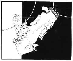
the southern bank of the Sloterplas [lake], the public space at the western end of the Lelylaan is the location for the design. Van Eesteren designed the Sloterplaas as an essential part of Plan West [1932], which itself was part of Amsterdams Algemeen Uitbreidings Plan, the AUP [general extension plan]. the distinct layout of the design still forms the basis of the city plan in this part of Amsterdam: two radial urban extensions not separated from each other by a green zone but in fact arranged around a central non-built area: the Sloterplas with the Sloterpark. these two urban extensions are themselves linked and also connected to other districts by a clear network of roads with predominantly north-south orbital motorways and east-west radial connections. not only does the Sloterplas have a recreational function within the Plan West,it is also used as a connection element. by building on both the north and the south of the sloterplas, an axis has been created across the water which connects the two radial extensions. assignment it is not the existing urban context that provides the point of departure, but a restructuring plan by the De Nijl partnership for the redevelopment of the urban axis: the Cornelis Lelylaan between Ring West and the south bank of the Sloterplas. the assignment is to transform the area which lies within these boundaries and to design a public space on the south bank. the only feature of the De Nijls restructuring plan to be used for the location is the repositioning of the motorway across the Cornelis Lelylaan. the routing of the existing tram line is to be retained, or conversely, repositioned on the bank. the residential towers on the waters edge are replaced by a public space with a new programme. the assignment is to design a quay and a promenade along the bank which link the community centre on the north-west side [Osdorpplein] with the yacht-basin on the east side. a new AUP pavillion on the promenade serves as an information centre for the western garden cities. its main function is to give information about the changes that will take place there over the coming years. |
|||
 |
|
| programme
landscape
pavillion
|
|